🎉 Up to 70% Off Selected ItemsShop Sale
Select Map Finish
From $5.21
Original: $17.36
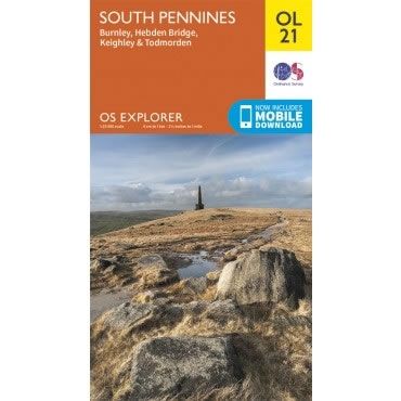
-70%OS Explorer Map OL21 - South Pennines—
$17.36
$5.21The Story
This OS Explorer OL21 Map covers the South Pennines, including Burnley, Hebden Bridge, Keighley and Todmorden. This area is criss-crossed by footpaths, including the Pennine Way and Calderdale Way, with the highest peak being Lad Law at 517m.
The scale of this OL 21 Explorer map is 1:25,000 where 4cm equals 1km, or 2.5 inches equals 1 mile.
With this map you will receive a code for a free mobile download onto your smartphone or tablet (iOS or Android).
The scale of this OL 21 Explorer map is 1:25,000 where 4cm equals 1km, or 2.5 inches equals 1 mile.
With this map you will receive a code for a free mobile download onto your smartphone or tablet (iOS or Android).
Description
This OS Explorer OL21 Map covers the South Pennines, including Burnley, Hebden Bridge, Keighley and Todmorden. This area is criss-crossed by footpaths, including the Pennine Way and Calderdale Way, with the highest peak being Lad Law at 517m.
The scale of this OL 21 Explorer map is 1:25,000 where 4cm equals 1km, or 2.5 inches equals 1 mile.
With this map you will receive a code for a free mobile download onto your smartphone or tablet (iOS or Android).
The scale of this OL 21 Explorer map is 1:25,000 where 4cm equals 1km, or 2.5 inches equals 1 mile.
With this map you will receive a code for a free mobile download onto your smartphone or tablet (iOS or Android).