Original: $10.62
-70%$10.62
$3.19The Story
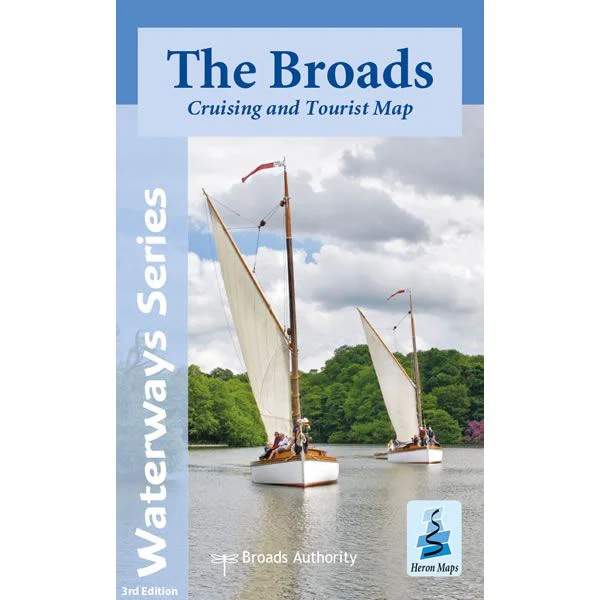
This Heron waterways map covers The Broads providing detailed information for both waterways and leisure users. The map is complimented by information panels and photographs.
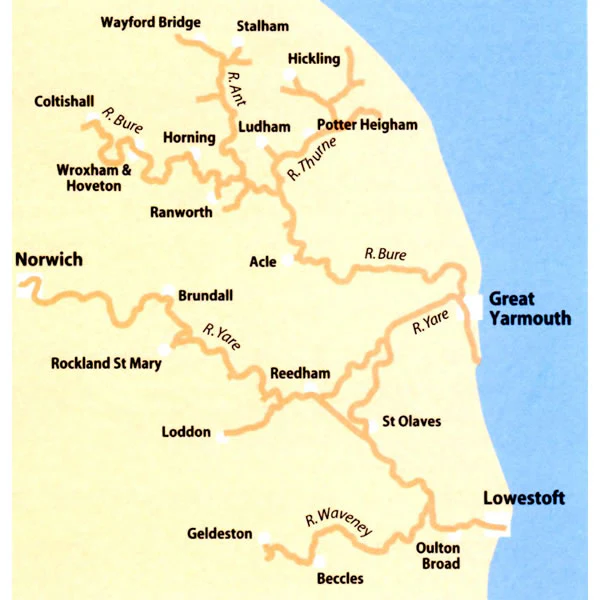
This cruising and tourist map of the Broads is at a scale of 1:50,000. Also included are detailed town plans for Wroxham and Hoveton, Stalham, Horning, Potter Heigham, Norwich, Brundall, Beccles, Loddon, Great Yarmouth, Reedham and Oulton Broad, at a scale of 1:12,500.
This is a double side map, with the map on one side and boating and visitor information of the other. The map shows navigation information, visitor moorings, boatyards, boat hire centres, facilities for the boat user and shops. Tourist information includes places of interest, pubs, nature reserves, windmills, churches, long distance paths, public toilets and caravan and camp sites. The reverse side has detailed boating information including location of visitor moorings, details of facilities at boatyards and marinas, journey times, day boat hire and boat trip locations, as well as contact details and opening times for a wide selection of visitor destinations and attractions, canoe and cycle hire details and some useful waterways contact numbers.
The Broads is Britain's largest protected wetland, covering some 300 sq km. Its rivers, broads, marshes and fens make it a unique area with some rare habitats, plants and wildlife. It was the arrival of the railways in the late 19th century that opened the area to tourism. Today it is one of the most popular inland waterways with in excess of 125 miles of lock-free navigable waterways. Other popular activities include fishing, walking, cycling and bird watching.
Published in May 2021 by Heron Maps this is the revised 3rd edition of this map.
Scale is 1:50,000.
ISBN is 9781908851352.
Details & Craftsmanship
Every detail has been carefully considered to bring you the perfect product.
Description
This Heron waterways map covers The Broads providing detailed information for both waterways and leisure users. The map is complimented by information panels and photographs.
This cruising and tourist map of the Broads is at a scale of 1:50,000. Also included are detailed town plans for Wroxham and Hoveton, Stalham, Horning, Potter Heigham, Norwich, Brundall, Beccles, Loddon, Great Yarmouth, Reedham and Oulton Broad, at a scale of 1:12,500.
This is a double side map, with the map on one side and boating and visitor information of the other. The map shows navigation information, visitor moorings, boatyards, boat hire centres, facilities for the boat user and shops. Tourist information includes places of interest, pubs, nature reserves, windmills, churches, long distance paths, public toilets and caravan and camp sites. The reverse side has detailed boating information including location of visitor moorings, details of facilities at boatyards and marinas, journey times, day boat hire and boat trip locations, as well as contact details and opening times for a wide selection of visitor destinations and attractions, canoe and cycle hire details and some useful waterways contact numbers.
The Broads is Britain's largest protected wetland, covering some 300 sq km. Its rivers, broads, marshes and fens make it a unique area with some rare habitats, plants and wildlife. It was the arrival of the railways in the late 19th century that opened the area to tourism. Today it is one of the most popular inland waterways with in excess of 125 miles of lock-free navigable waterways. Other popular activities include fishing, walking, cycling and bird watching.
Published in May 2021 by Heron Maps this is the revised 3rd edition of this map.
Scale is 1:50,000.
ISBN is 9781908851352.